
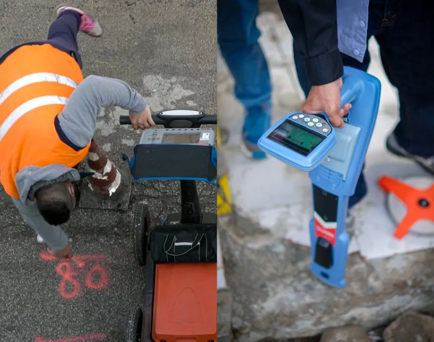
GPR Scanning vs Electromagnetic Locating: What Is the Difference?
Underground pipes, cables and other buried infrastructure cannot all be identified using the same technology. The most suitable method depends on factors such as the service material, available access points, ground conditions and the purpose of the investigation.
Ground penetrating radar and electromagnetic locating are two commonly used methods. Electromagnetic locating follows a detectable signal associated with a conductive service, tracer wire or sonde. GPR scanning searches for radar reflections produced by buried objects and changes in subsurface materials.
Neither method is universally better. Professional underground locating services may use one or both technologies alongside plans, visual evidence and physical verification.
What Is Electromagnetic Locating?
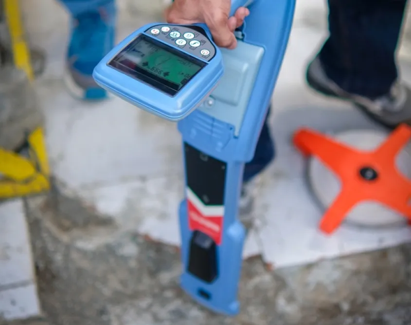
Electromagnetic locating uses a transmitter and receiver to trace a signal associated with an underground service.
Where possible, the transmitter applies a signal directly to a conductive pipe, cable or tracer wire. A receiver is then moved across the surface to detect the signal and follow its likely underground route.
Signals can be applied or detected in several ways:
- Directly connecting the transmitter to an accessible service
- Applying a signal through a clamp
- Inducing a signal from above ground
- Detecting passive power or radio signals already present
- Inserting a detectable sonde into an accessible pipe or duct
The pipe and cable locator selects the method according to the service, access points and surrounding infrastructure.
What Can Electromagnetic Locating Detect?
Electromagnetic equipment is commonly used to trace:
- Electrical cables
- Telecommunications and data cables
- Metallic pipes
- Conductive conduits
- Non-metallic pipes installed with tracer wire
- Accessible pipes or ducts containing a sonde
The equipment does not detect an asset simply because it is underground. It detects the signal carried by or associated with that asset.
This distinction is important when investigating plastic, concrete and other non-conductive pipes. If the pipe does not contain a tracer wire and a sonde cannot be inserted, electromagnetic locating may not be able to trace it directly.
What Is GPR Scanning?
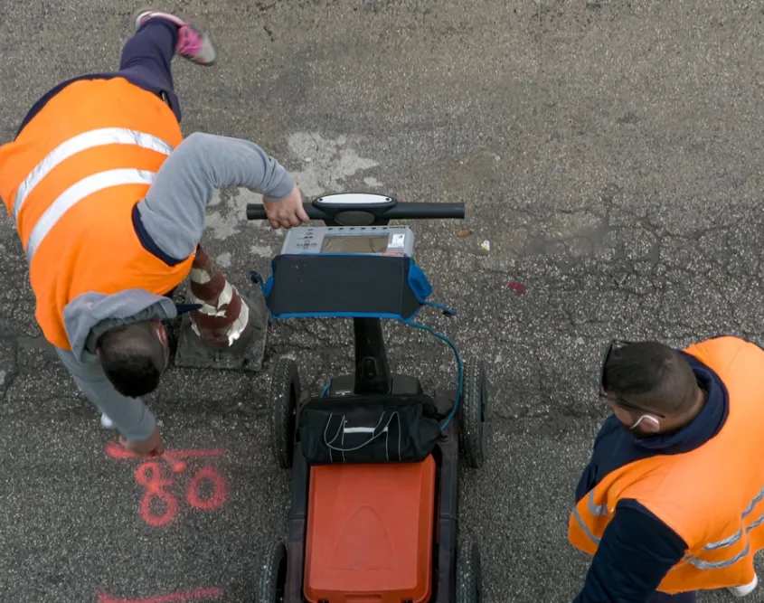
Ground penetrating radar, commonly called GPR, is a non-destructive investigation method that sends radar energy into the ground. The signal reflects when it encounters an object or a boundary between materials with different electromagnetic properties.
A trained operator collects and interprets these reflections to identify features that may require further investigation.
GPR scanning services may assist with finding:
- Metallic and non-metallic pipes
- Underground cables
- Buried structures and foundations
- Storage tanks
- Voids
- Changes in ground conditions
- Other subsurface anomalies
GPR does not produce a simple photograph of everything beneath the surface. A reflection can indicate that an object or material change is present without independently confirming exactly what it is.
What Is the Main Difference?
The simplest distinction is:
Electromagnetic locating follows a detectable signal associated with a particular service, while GPR scans an area for reflections that may indicate buried objects or changes beneath the surface.
Electromagnetic locating can be effective when an underground utility locator needs to identify and follow a conductive service through a site.
GPR can investigate conductive and non-conductive targets without connecting a transmitter to them. However, its results require interpretation, and a detected anomaly may not reveal the asset’s ownership, condition or purpose.
GPR vs Electromagnetic Locating at a Glance
| Factor | Electromagnetic locating | GPR scanning |
| Detection method | Follows a detectable signal | Interprets radar reflections |
| Common targets | Conductive pipes, cables, tracer wires and sondes | Conductive and non-conductive objects or anomalies |
| Direct connection | Sometimes required or preferred | Not required |
| Route tracing | Often effective with a clear signal | Possible through interpreted scan data |
| Asset identification | Can help follow a known service | May detect an object without identifying its function |
| Main limitations | Signal access, interference and non-conductive materials | Soil, moisture, depth, target size and data interpretation |
When Is Electromagnetic Locating Most Useful?
Electromagnetic locating is particularly useful when:
- An accessible conductive service is available.
- The route of an electrical or communications cable must be traced.
- A metallic pipe can carry an applied signal.
- A non-metallic pipe has an intact tracer wire.
- A sonde can be inserted into a pipe or duct.
- One service needs to be distinguished from surrounding infrastructure.
The equipment may also provide an estimated depth when signal conditions are suitable. That measurement remains an estimate and should not replace appropriate physical verification.
When Is GPR Scanning Useful?
GPR scanning services may add value when:
- Utility plans are incomplete or unclear.
- Plastic or other non-conductive pipes may be present.
- There is no suitable transmitter connection point.
- Unknown buried objects or structures are suspected.
- A site may contain abandoned or undocumented infrastructure.
- A broader subsurface investigation is required.
GPR is often used as a complementary method rather than as a guaranteed solution for every service that cannot be detected electromagnetically.
What Affects Electromagnetic Locating Results?
Several conditions can affect signal-based locating:
- Weak or unavailable signals
- Missing or damaged tracer wires
- Limited access to connection points
- Signals transferring onto adjacent services
- Parallel conductive pipes or cables
- Congested utility corridors
- Cable shielding
- Service depth
- Interference from nearby infrastructure
An experienced service locator can compare readings, change frequencies and assess information from plans and surface features. However, some sites remain difficult to interpret even with professional equipment.
What Affects GPR Results?
GPR performance can be affected by:
- Soil composition
- Moisture levels
- Clay-rich or electrically conductive ground
- Target depth and size
- The material of the target
- Surface access and condition
- Reinforcement, rubble or buried debris
- Closely spaced underground features
Radar requires sufficient contrast between the target and the surrounding material. Some ground conditions absorb or restrict the signal, reducing the depth or clarity of the investigation.
These limitations are why GPR data must be interpreted by a trained operator rather than treated like an underground photograph.
Why Are Both Methods Often Used Together?
The two technologies provide different forms of evidence and can compensate for some of each other’s limitations.
For example, electromagnetic equipment may trace an electrical cable or metallic water pipe across a site. GPR may then investigate the surrounding area for non-conductive pipes, abandoned infrastructure or unidentified subsurface features.
Available plans and visible clues—such as pits, meters, valves and conduits—help the underground service locator interpret both sets of results.
Combining methods can improve confidence and reveal discrepancies that might be missed when relying on one source. It does not guarantee that every buried service will be detected, particularly where site conditions or asset characteristics limit both technologies.
Is Either Method the Same as Cable Fault Detection?
Utility locating and cable fault detection are related but different services.
Locating establishes the likely route of an underground cable. Fault detection aims to identify a defect at a particular point along that route. The cable may need to be traced before specialised testing can pinpoint the fault.
Finding the cable does not show whether it is damaged. Similarly, confirming an electrical fault does not automatically reveal the cable’s complete route. Underground fault investigations may also require coordination with an appropriately qualified electrician.
Do the Results Confirm Exact Position and Depth?
Both methods produce interpreted findings affected by the equipment, site conditions, asset characteristics and operator access. Surface markings indicate the likely position of detected features and carry a degree of tolerance.
Underground utilities should not be assumed to travel in straight lines or remain at a consistent depth. Before mechanical excavation near a marked service, careful hand excavation, non-destructive digging or another approved verification method may be required.
Choosing the Right Locating Method
Electromagnetic locating is primarily a signal-based method for tracing conductive services, tracer wires and sondes. GPR scanning is a radar-based method for investigating buried objects and changes beneath the surface.
The appropriate method depends on what may be underground, the site conditions and the information required. Professional underground utility locating services may combine service plans, visual assessment, electromagnetic equipment, GPR and targeted verification to develop the clearest practical understanding of a site before excavation begins.
You Might Be Interested In: Safety Equipment Checklist That You Should Consider While Welding
